"Mossgiel", Sweetmans Avenue, Pinner
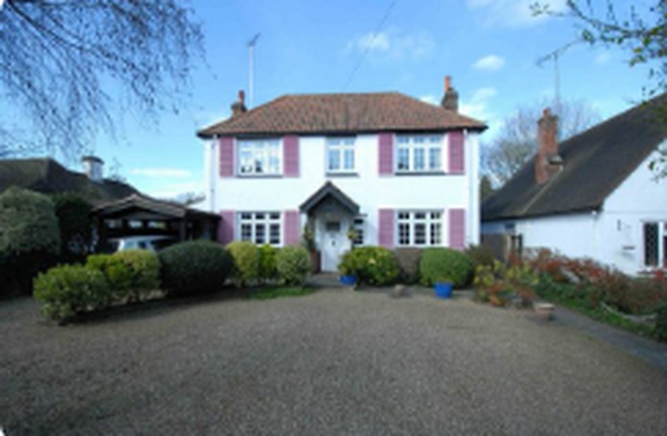
"Mossgiel", Sweetmans Avenue, Pinner
When she was there: c.1939, and the Pinner address held to 1943 (dates disputed, see below)
Mossgiel — a white-rendered detached house with plum-painted shutters and a tiled roof, two stacks, a central pillared porch between square bays, and a broad gravel forecourt behind clipped shrubs. A carport to the left. Supplied by Will, 16 August 2026, as the Sweetmans Avenue house. Sweetmans Avenue has no Street View coverage — it is an unadopted private lane — so this is from a property listing rather than a street capture, and the house number is still not established.
Also not their own house. Elizabeth named the household on the recording, immediately and without prompting:
“Then Mossgiel on— Mossgiel is Auntie Ivy.“
“The Griffiths family. It was very close, partly because — well, mostly all because of the fact that my father worked for Uncle Griff.“
Auntie Ivy was Mrs Griffiths, and Uncle Griff ran his own accountancy practice locally and employed Charles Wynne — employer and landlord in one household. (Corrected 16 Aug 2026: the Cooper Brothers career, the Lever Brothers account and Port Sunlight were Charles Wynne’s own, later, not Griffiths’s.) Their daughter Mary Griff became an actress, worked at the Farnham theatre, and lived at 3 St Mary’s Mansions, Paddington, where she refused to sell to developers buying up the block.
⚠ The order here is Will’s, not the documents’. The archive dates Mossgiel from the bank’s letter of 28 May 1943, which is after Westbury; Will places it before, and Elizabeth on the recording puts Pinner first and is unsure whether Mossgiel was in Pinner at all. The likeliest reconciliation is the onealready offered as a possibility: they held the Pinner address throughout, which is why the bank wrote there in 1943 — “Captain Wynne called the other day” — while Ella and Elizabeth were in Shropshire. On that reading Mossgiel is where they went from Marsworth Avenue, and it stayed the family’s postal address.
Also recorded in The Wynne houses: 3. "Mossgiel", Sweetmans Avenue, Pinner
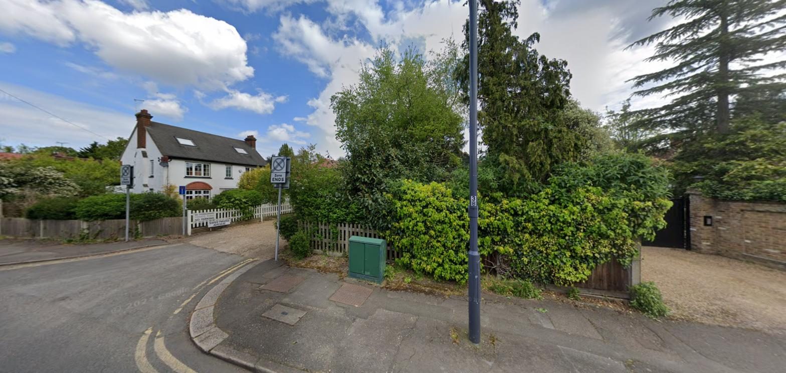
The mouth of Sweetmans Avenue at West End Lane — the private lane running up past the white house, with its “NO PARKING — SWEETMANS AVENUE” sign on the fence.
Google Street View, imagery of 2024, captured 14 August 2026. This is as far as the Street View car went: Sweetmans Avenue itself is an unadopted private lane and has no Street View coverage at all. © Google — held here for family reference, not for republication.
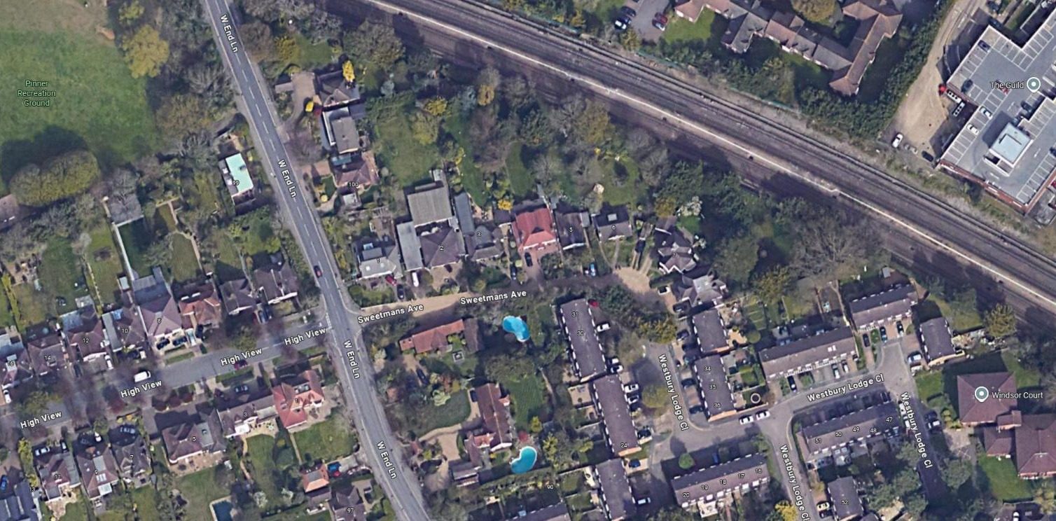
Sweetmans Avenue from above — West End Lane on the left, the Metropolitan line at the top, and the whole avenue between them: a handful of large detached houses in long gardens.
Google Earth / Maxar and Airbus imagery, captured 14 August 2026. The numbered plots visible along the avenue are the entire street. One of them is Mossgiel. © Google — held here for family reference, not for republication.
What the archive proves. The family was at “Mossgiel, Sweetmans Avenue, Pinner” by 1943:
- The bank’s letter of 28 May 1943 about Captain Sutherland’s estate is addressed there. It is the same letter that opens “Captain Wynne called the other day and explained about the Mortgage Interest” — the only document in the archive that records Charles Wynne’s wartime rank, and the reason C7 asks which regiment.
Which house is Mossgiel? — searched 14 August 2026, not answered
Mossgiel is a house name, and house names get dropped when a street is numbered. The number was looked for properly and was not found. What the search did establish is the shortlist.
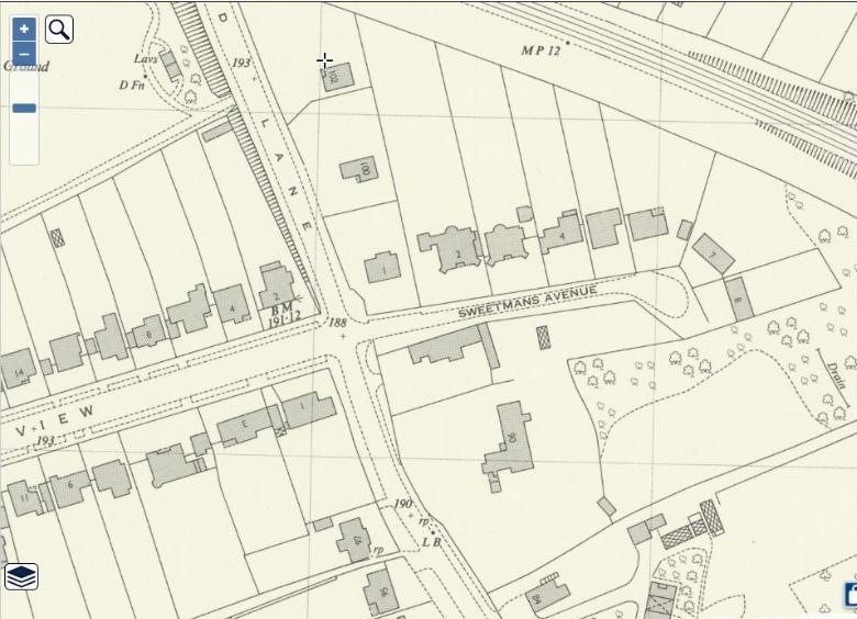
Ordnance Survey 1:1,250 National Grid plan, A edition (surveyed 1944–1975) — West End Lane down the left, Sweetmans Avenue running east to its turning head.
The plots carry numbers, not names: 1, 2 and 4 along the north side, 7 and 8 at the head of the avenue. By the time this sheet was surveyed the street was numbered, and the Ordnance Survey printed the numbers rather than the names. National Library of Scotland, georeferenced maps, CC-BY (NLS).
Where the number is not. Each of these was checked and each came back empty:
- HM Land Registry Price Paid open data (every sale since 1995, queried by street): eight transactions on Sweetmans Avenue, all at HA5 3NS, all recorded against numbers — 1, 2, 4, 6, 7, 8 — and not one against a house name. If Mossgiel had sold under its name since 1995 it would be here.
- The London Gazette, full archive: “Sweetmans Avenue” appears — including “Caversham, Sweetmans Avenue, Pinner, Middlesex” in a notice of 21 August 1951, which proves house names were still in ordinary use on the street then — but “Mossgiel” appears nowhere in the Gazette at all.
- The Ordnance Survey 1:1,250 plan above: numbers only, no names, for every plot on the avenue.
- Harrow planning register, archive.org full-text, and general web search: nothing. The only planning reference found for the street is a 2014 application at no. 4.
What that leaves. The avenue is a short private lane of roughly eight large detached houses, numbered 1–8, and Mossgiel is one of them. The name-to-number key for 1943 is not online: it sits in electoral registers and Kelly’s Directory of Middlesex for the 1940s and 1950s, held at the Harrow Local History Collection, and in the 1939 Register (Findmypast / Ancestry, subscription) — all of which list the house as Mossgiel against a household, and which, read against a numbered register a few years later, give the crossover.
A photograph of the house now exists, supplied by Will on 16 August 2026 — a white-rendered detached house with plum shutters, a central pillared porch and a gravel forecourt, evidently from a property listing rather than a street capture. It does not carry a number, so the name-to-number question below is still open; but the building can now be recognised on sight, which is what the next step needs.
The cheap answer is in the room. Show Elizabeth the aerial and the plan above. She lived there. She can very probably say which house it was on sight, and that is worth more than a directory search — see I4 and J.
The move is worth noticing in itself. Marsworth Avenue in 1938–39 is a new semi-detached street; Mossgiel in 1943 is a named house on a private lane of large detached ones. Whatever else was happening to that family in the war, they moved up. D3 — where Ella’s own money came from — is the question that sits underneath it.
Postcode today: HA5 3NS / HA5 3NT. Location of the avenue: 51.59461 N, 0.38790 W.